Where to Go after you pass Hell...
(...Map scales vary widely in the interest of showing some details of the interesting twisty bits, without dwelling on the more mundane sections...)To see a larger view of any map, click the image.
Two weeks vacation, a pair of motorcycles, and no fixed plans... We left home Saturday the 27th of August, 2011.
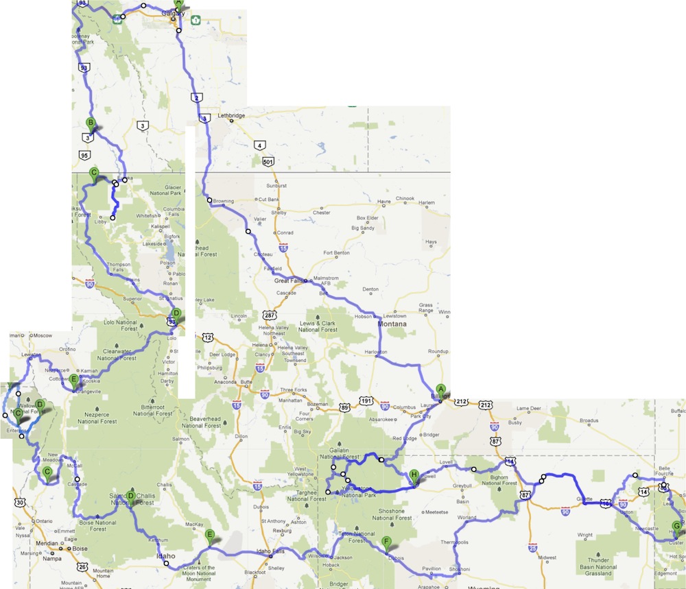
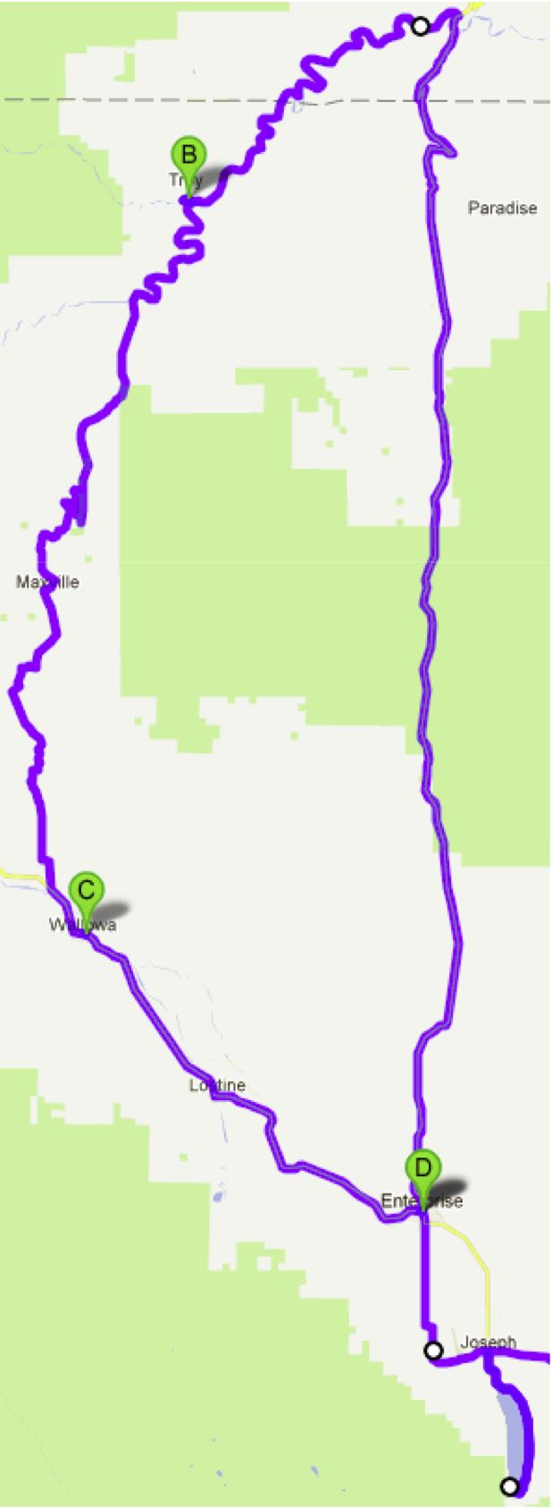
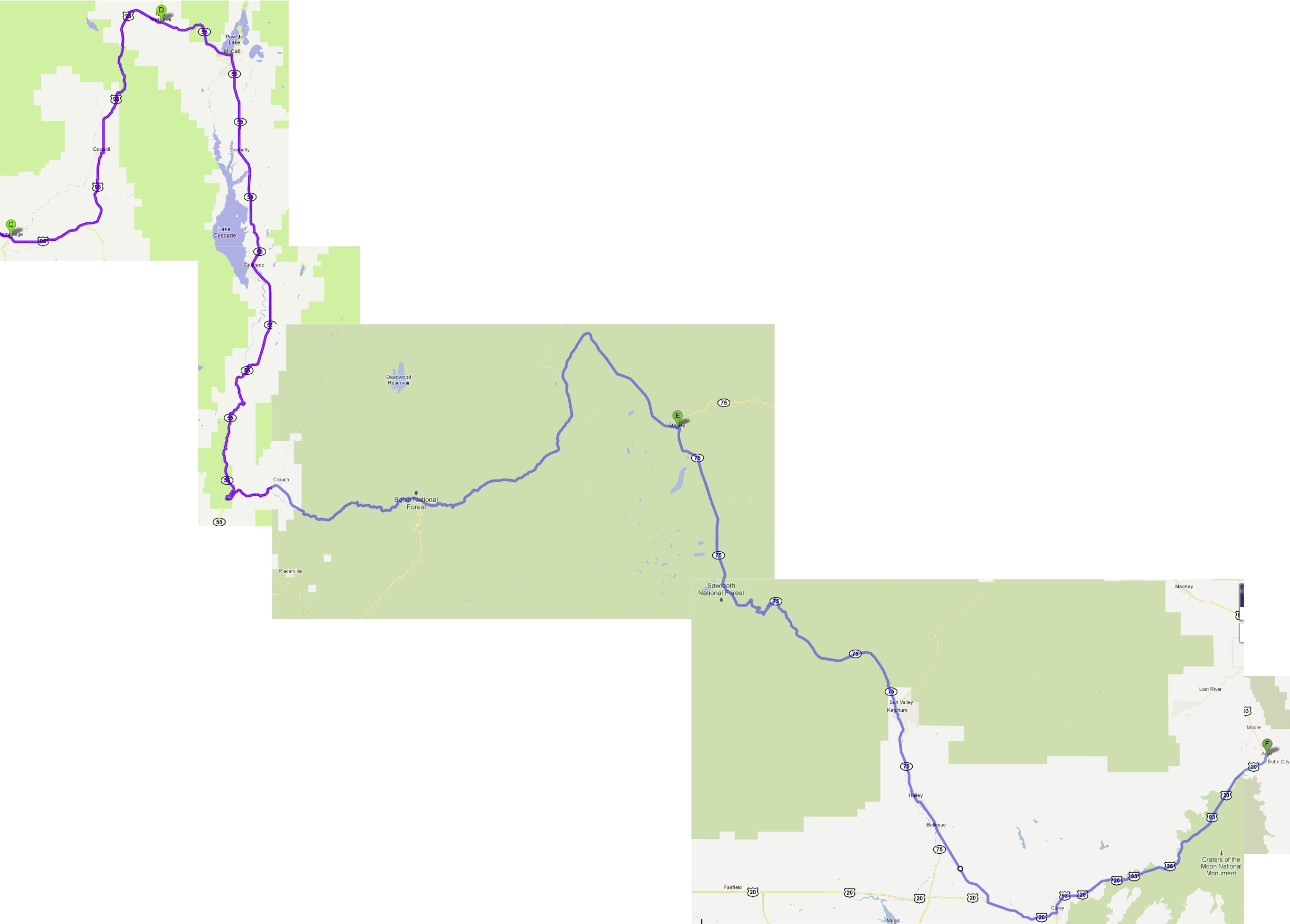
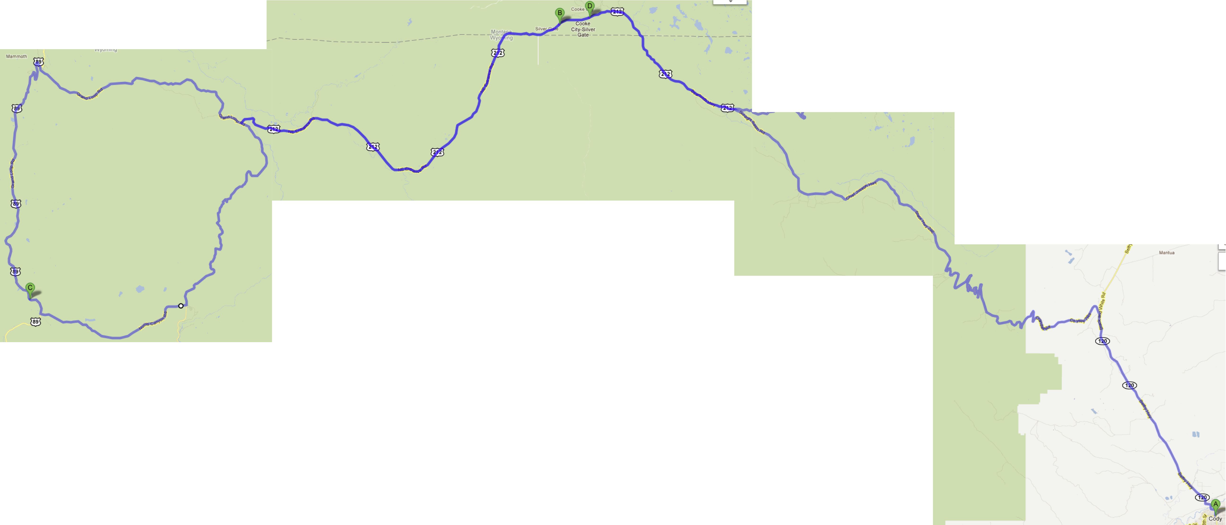
An approximate overview of the trip.
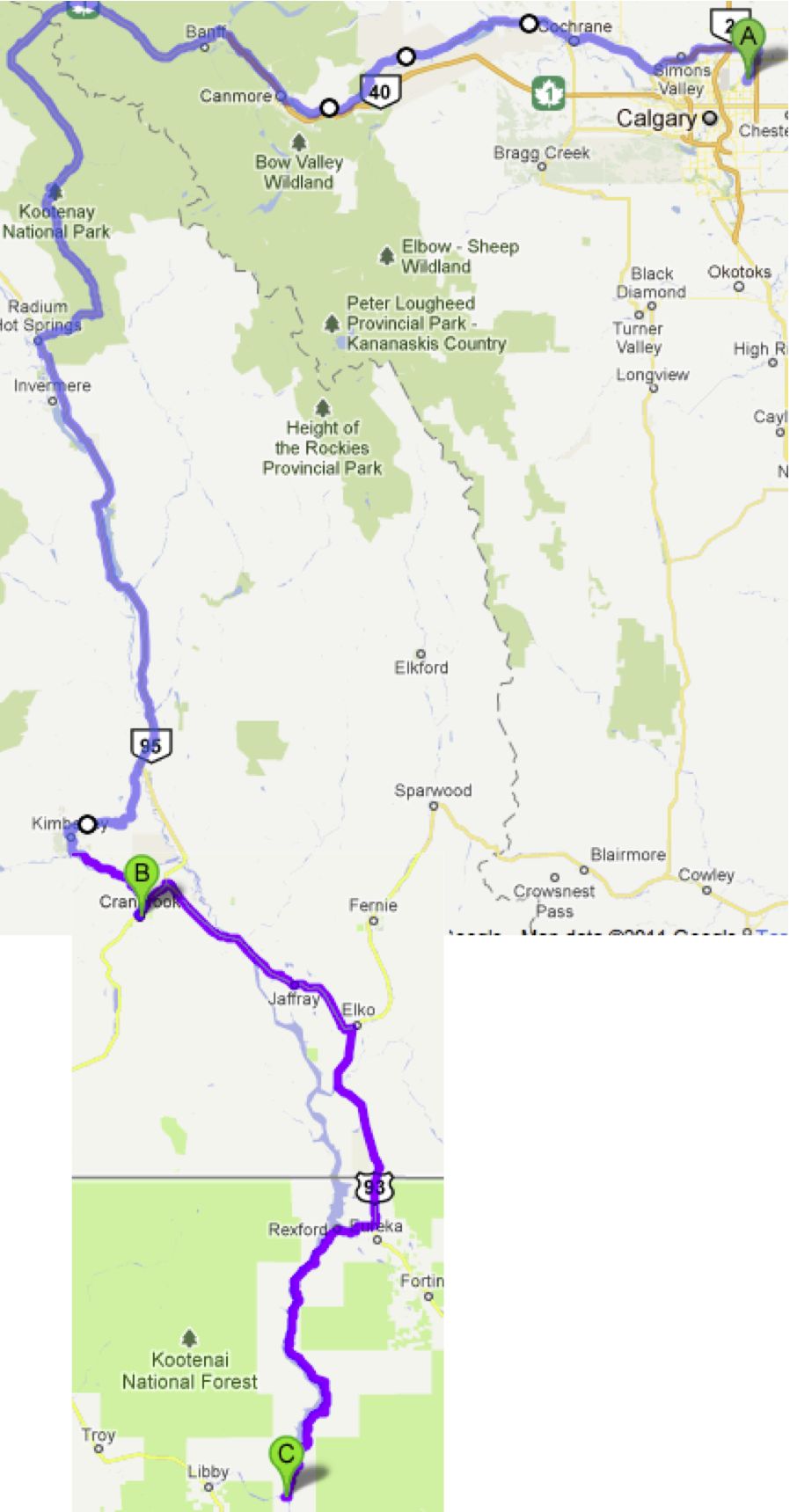
We've never ridden around Lake Koocanusa in the US before. Very nice!
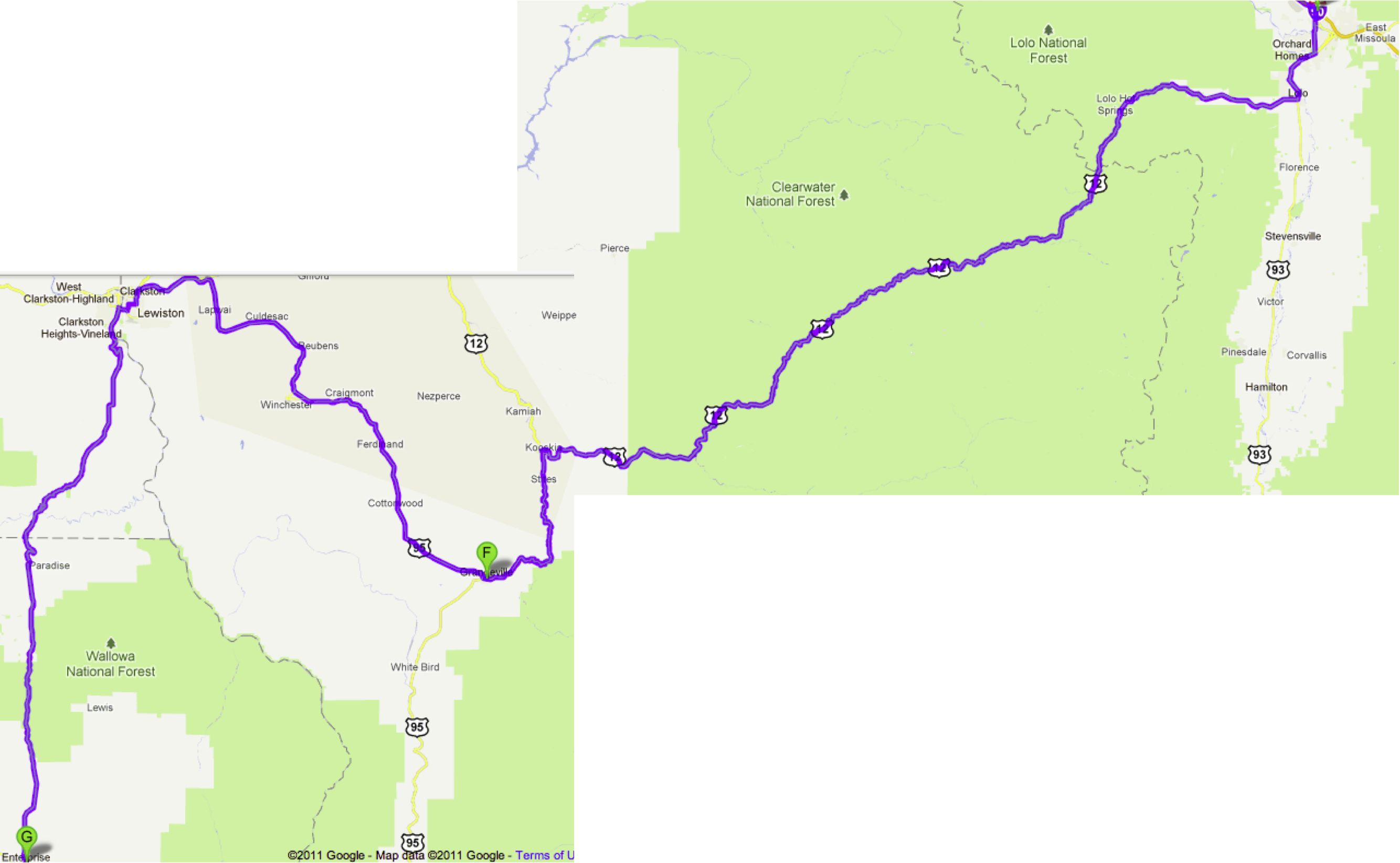
Lolo pass was fun, but how nutty it is that the speed limit drops by 20mph when you change states!
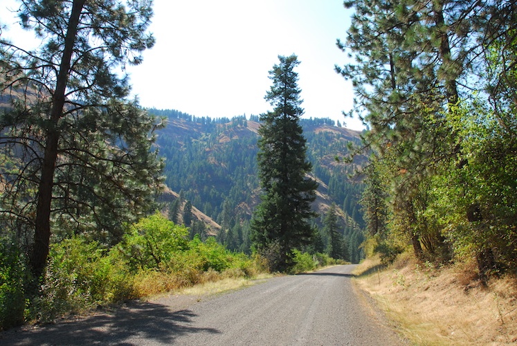
The twisty road into Grangeville was marred by construction and a BMW rider that sure knew how to use the throttle... on the straight bits. However, we still enjoyed the day.
We stayed two nights in Enterprise so as to enjoy the local roads, without luggage!
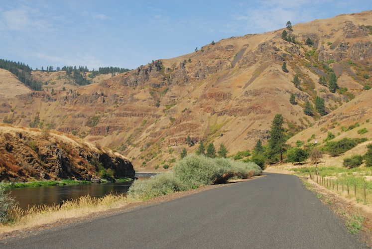
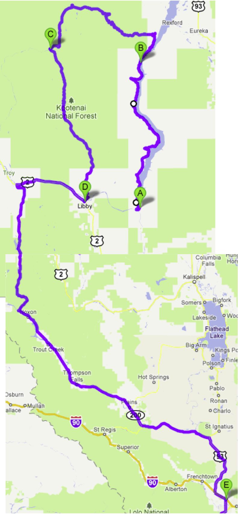
The nice twisty bits around Troy are mostly paved, with tarmac the same colour as the local greyish gravel.
We encountered about 60km of said local greyish gravel.

"Is there life out there?" We have no idea what this structure is the remains of.
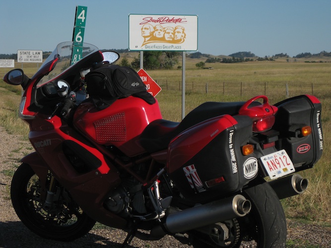
The Tire Gods must be screaming about the inappropriate use of premium sport bike tires. YOU try telling the Ducati it isn't a "Dual Sport".
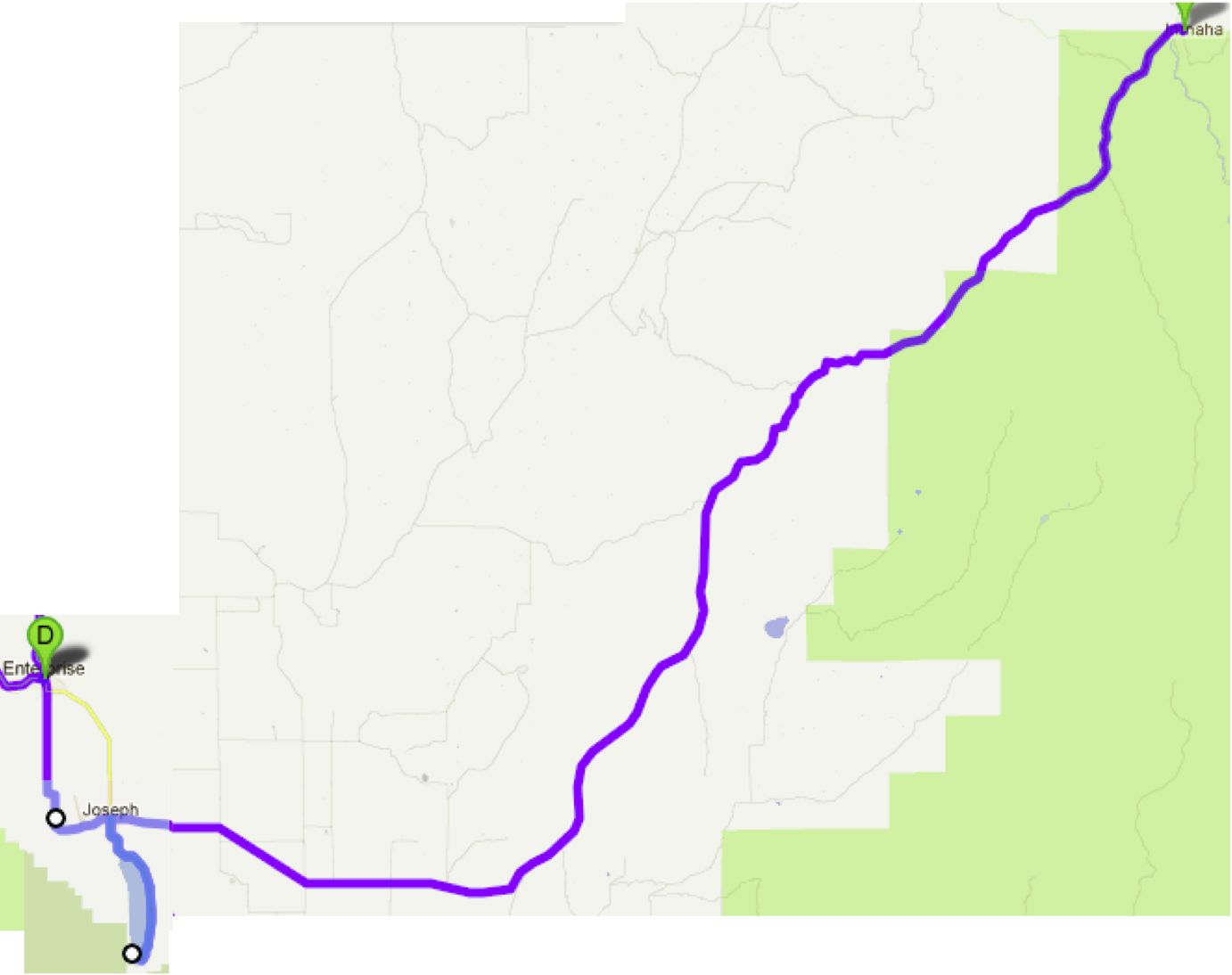
After lunch back in Enterprise (the *only* place we eat in this town is La Laguna, if it is open. Delicious Mexican food!!!) we headed off to Imnaha, with a short hop around Wallowa Lake.
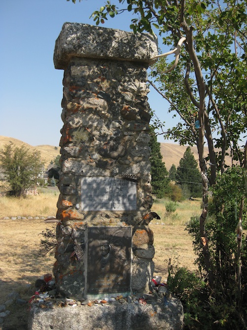
Chief Joseph's supposed final resting place (they've moved him around a bit over the years...). You'd think that they would know the year of his death, but in three places in this little roadside monument they had his date of death listed with three different years!!!
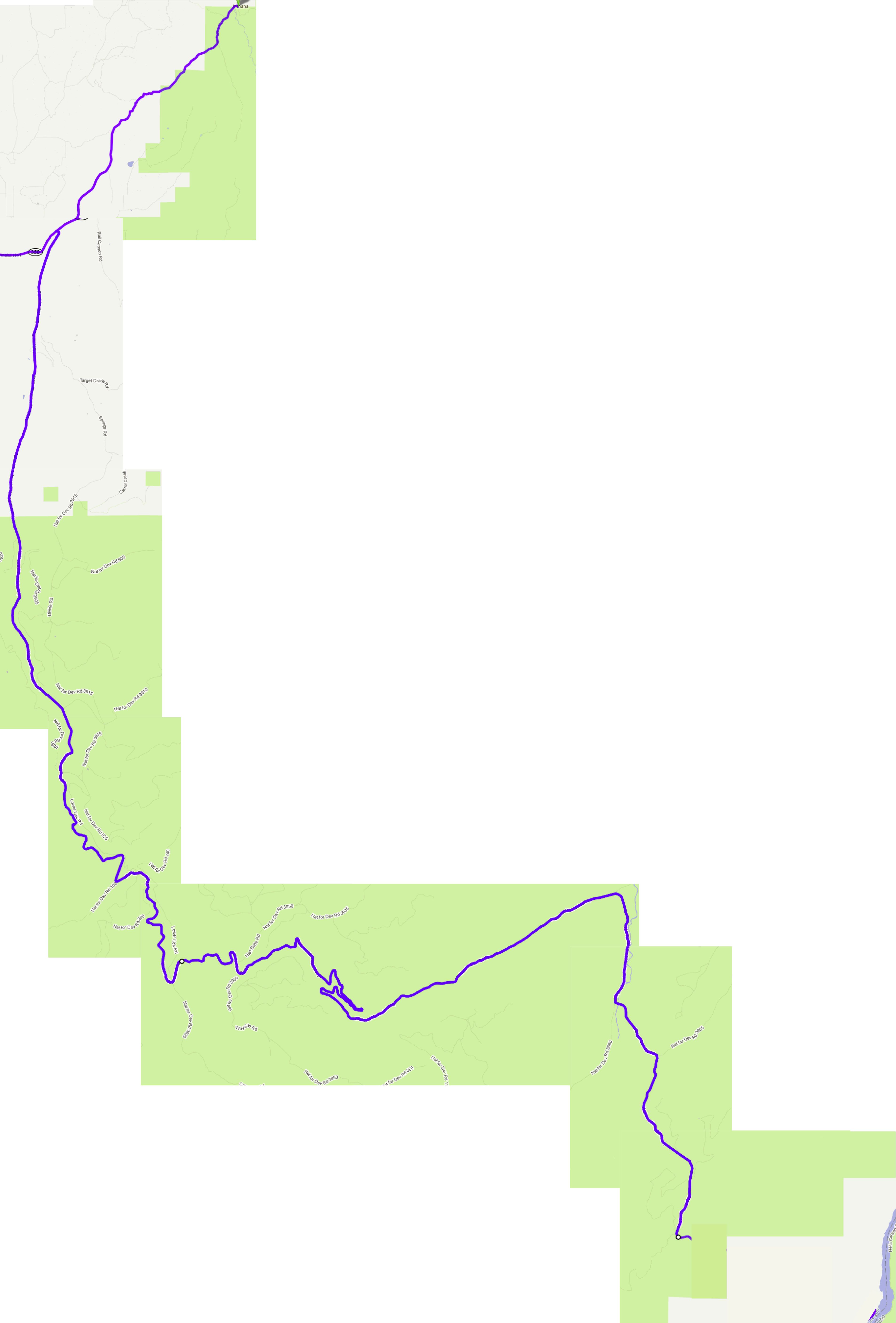
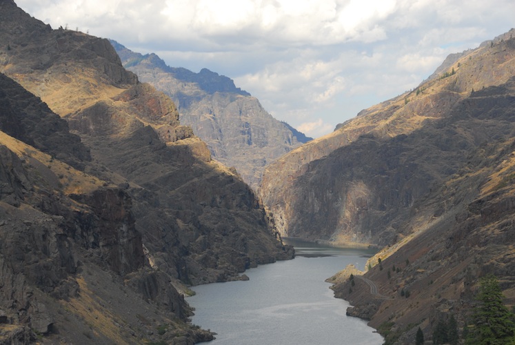
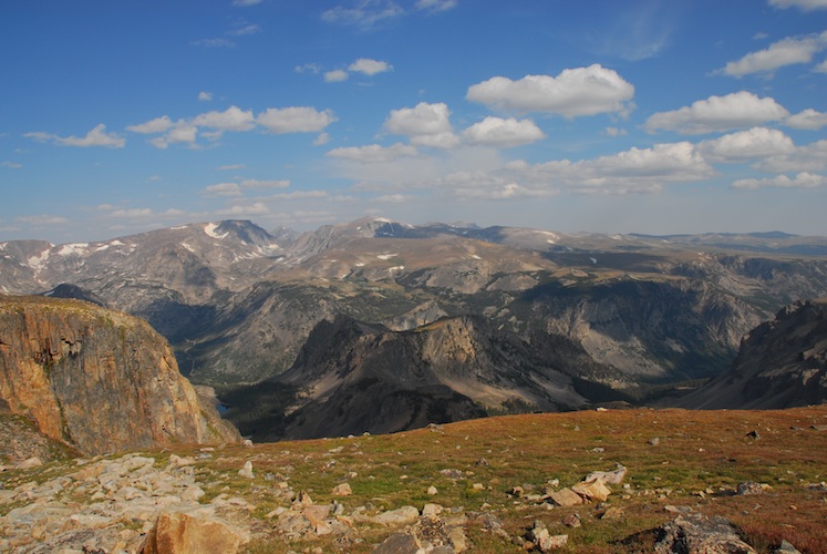
The road to the Hell's Canyon Overlook is twisty and fun.
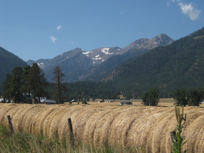
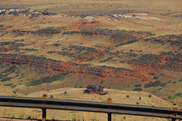
Small farms nestled in the mountains.
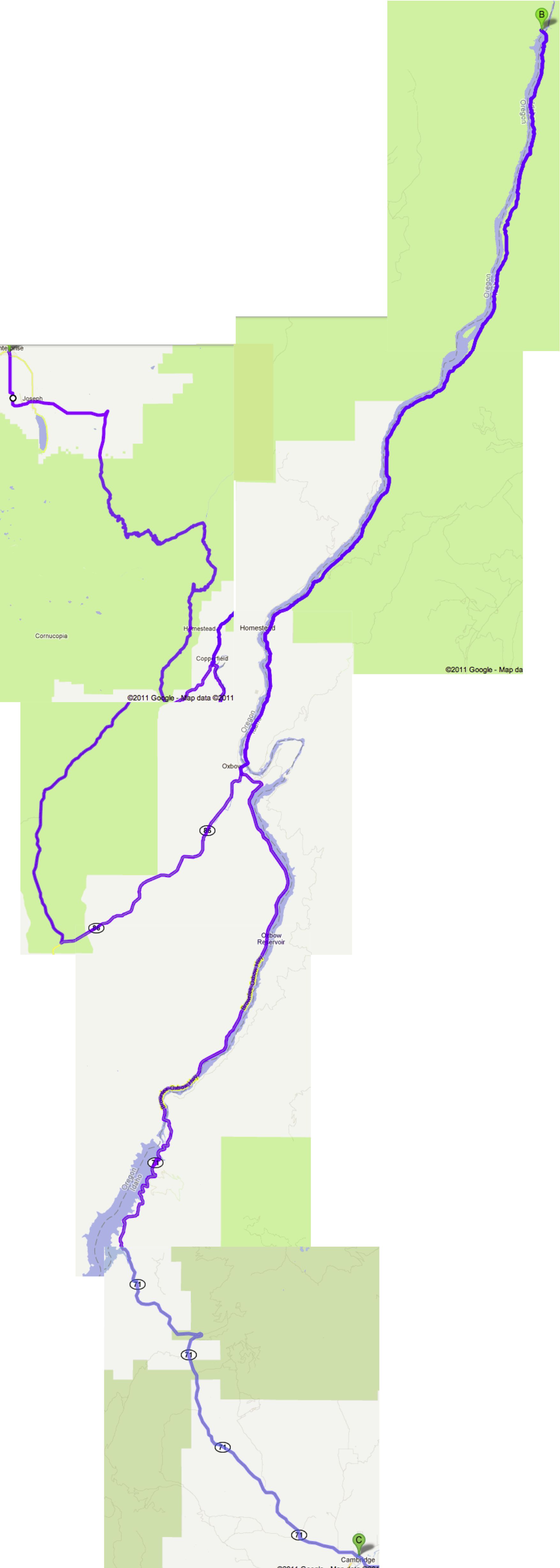
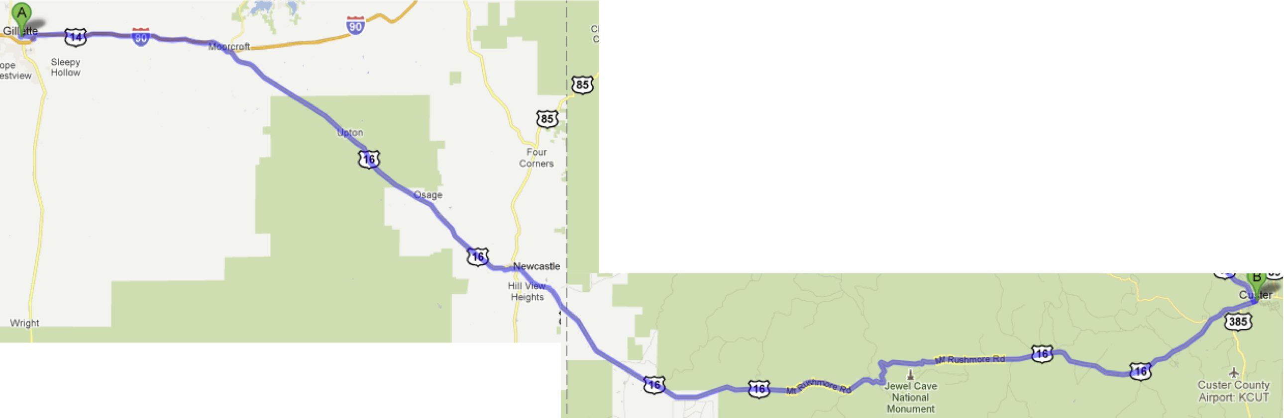
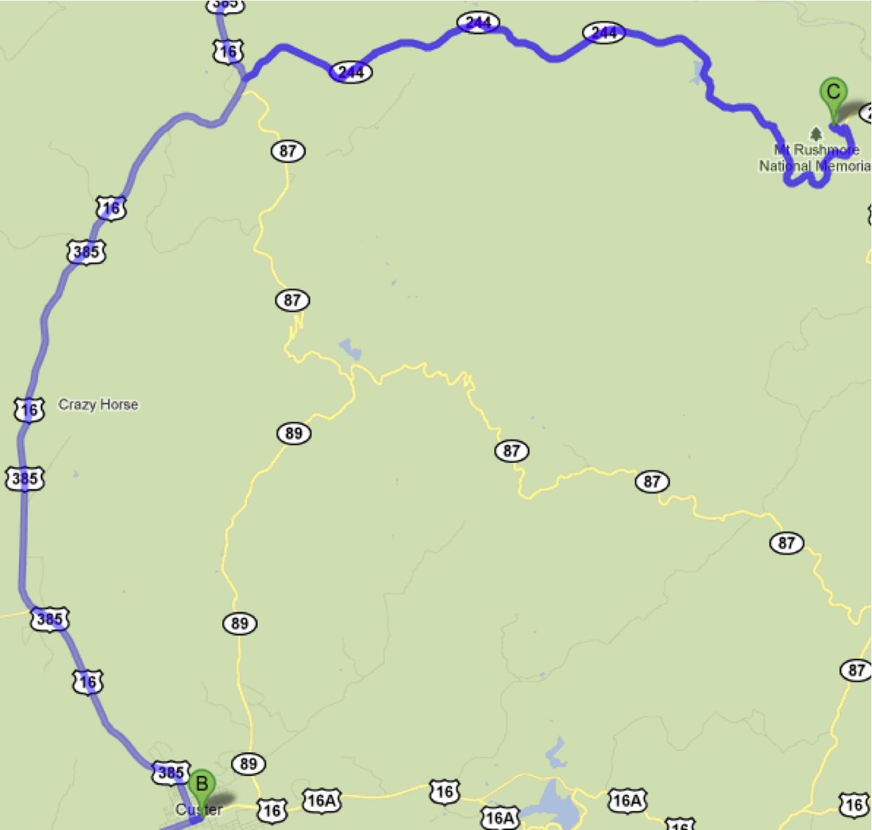
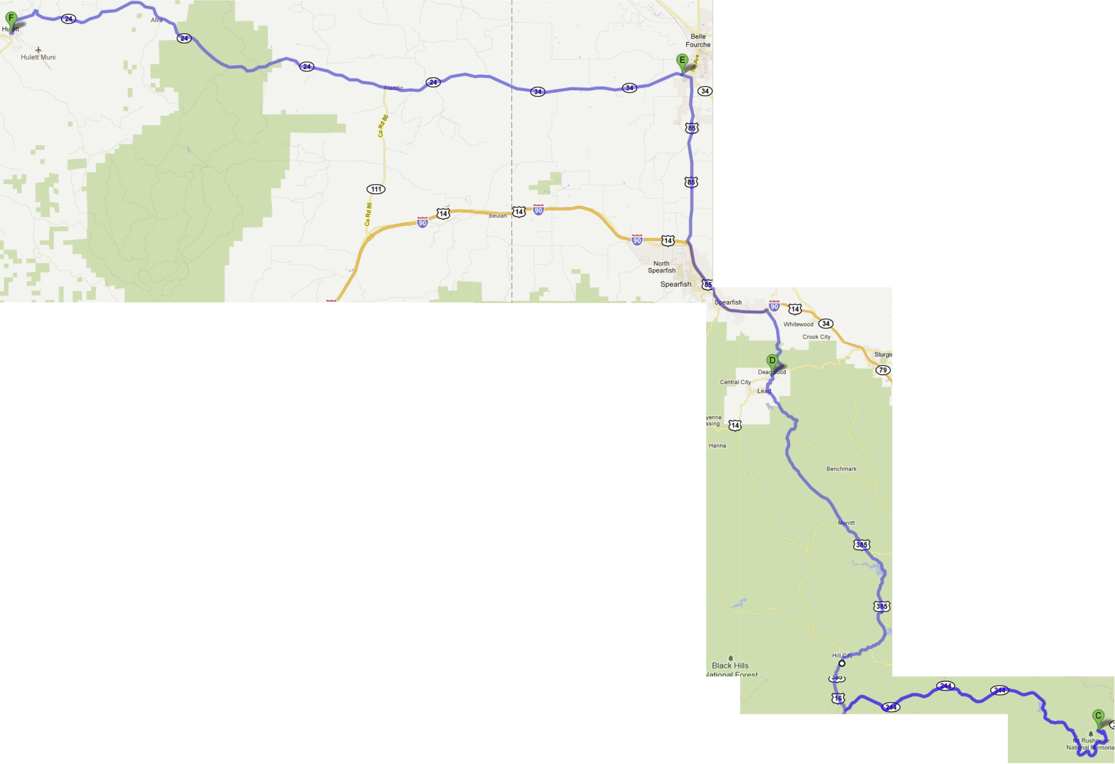
The above map looks a little funky, but it saves you from seeing the whole long road from Enterprise to the Hell's Canyon overlook, again...
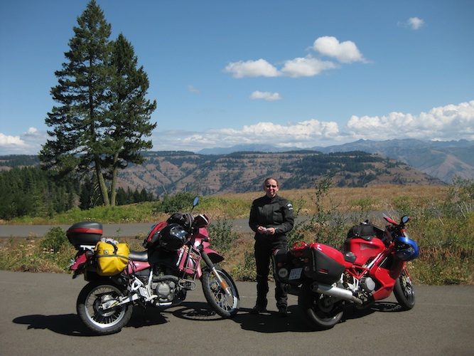
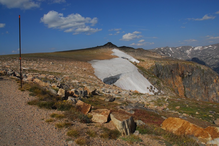
Despite having been to the overlook the previous day, we popped the couple of miles off of the main road again. The views are hard to get tired of, and today it wasn't overcast!
Another road we've ridden past many times but never been on before is north from Oxbow, along the Oregon/Idaho border, to Hell's Canyon Dam.
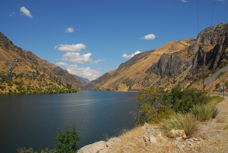
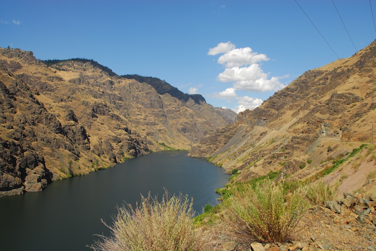
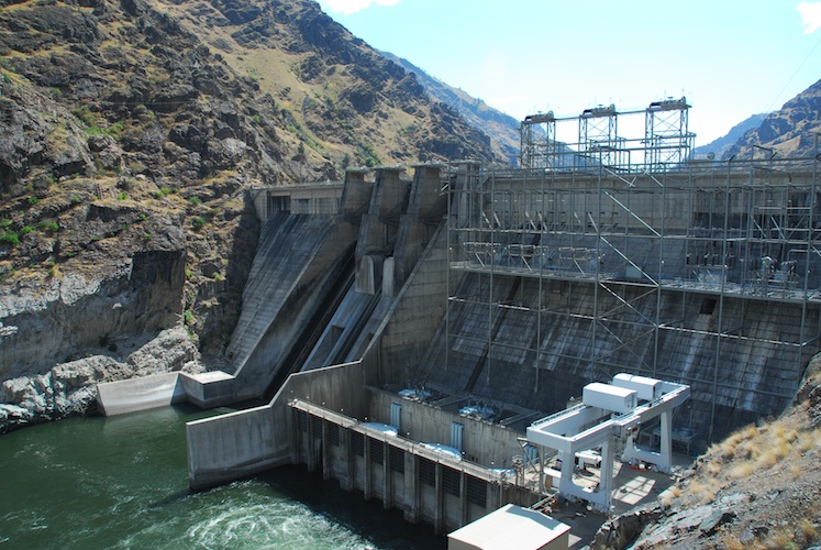
Despite the fact that you can't get anywhere from there, the road is well worth the ride, and just as enjoyable on the return trip!
Only in Idaho have we encountered the wonderful method of "mending" paved roads by laying down 12km (in this case) of fresh thick gravel, with just a smidge of an oily substance to "stick" it all together.
 How many months does
it take this stuff to fully become solid pavement again? Just
past the gravelly spot we traversed we came across a section we know
was done in early August -- it was better, but still not a confidence
inspiring surface.
How many months does
it take this stuff to fully become solid pavement again? Just
past the gravelly spot we traversed we came across a section we know
was done in early August -- it was better, but still not a confidence
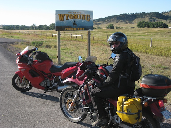
inspiring surface. From Cambridge, we had to decide where to go next, left or right. Perusing the maps, we noticed Wyoming just a little ways off, we'd never been there before! What's in Wyoming - Yellowstone! OK, but we'd have landed there labour day weekend, so we decided to take a little side trip through South Dakota first...
Last time we rode through this area, we got to Craters of the Moon after the Visitor's Centre had closed. This time we made it there early enough in the day to go inside. We learned a lot, and it was an interesting lead up to visiting Yellowstone, as the underground phenomena are linked.
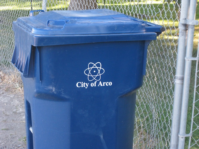
Where do you keep your nuclear waste?
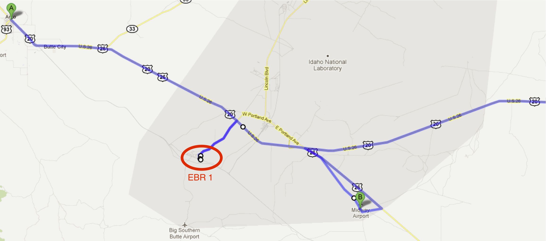
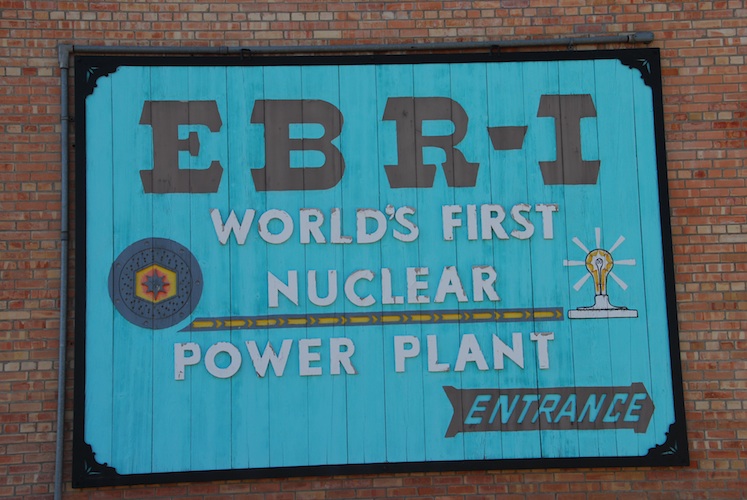
What we thought would be a short visit to the first Experimental Breeder Reactor took most of a morning - it was worth it!
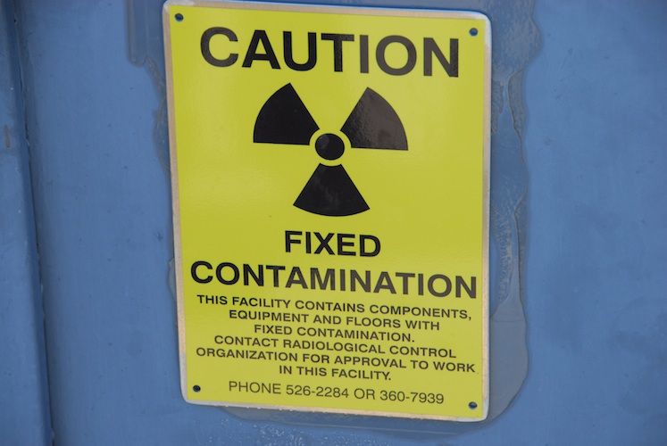
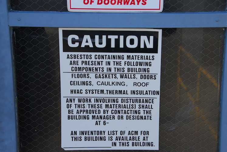
With all these warnings, would YOU enter?
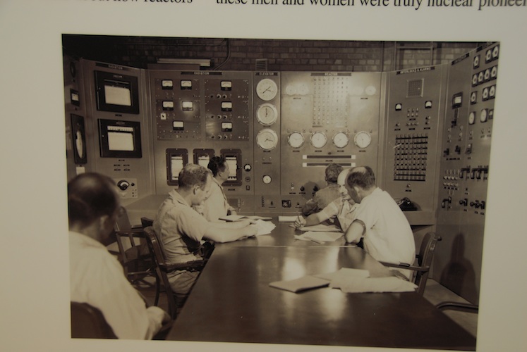
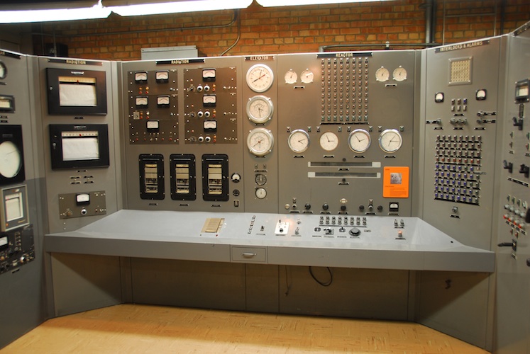
The ERB1 control room, then and now.
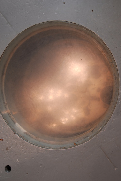
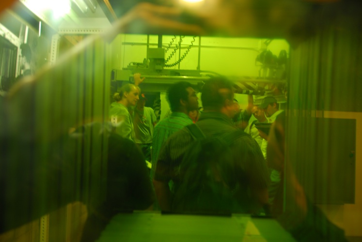
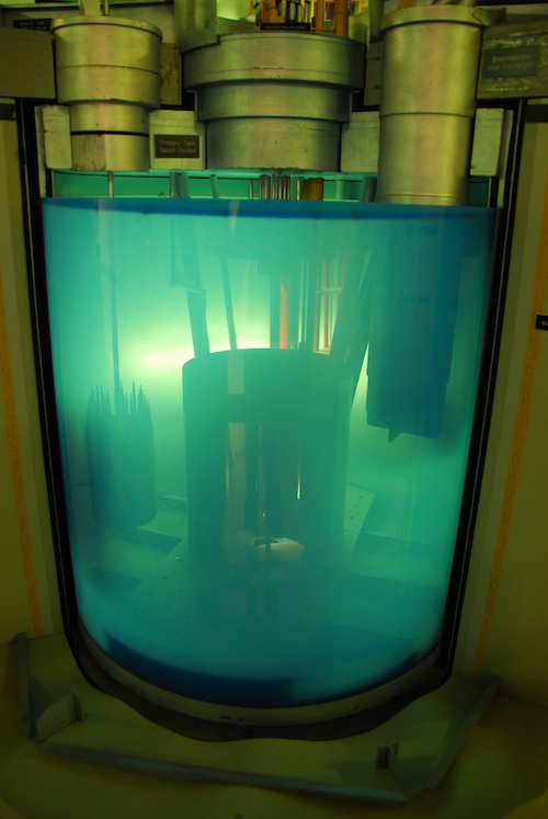
Looking through MANY layers of oil and glass at the core of the reactor.
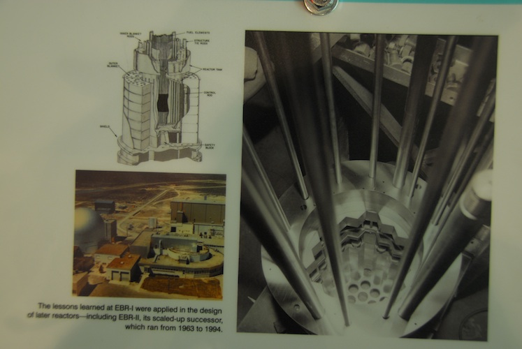
For a better view they have pictures and schematics.
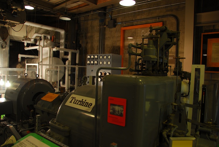
The turbine that first generated electricity from a nuclear plant.
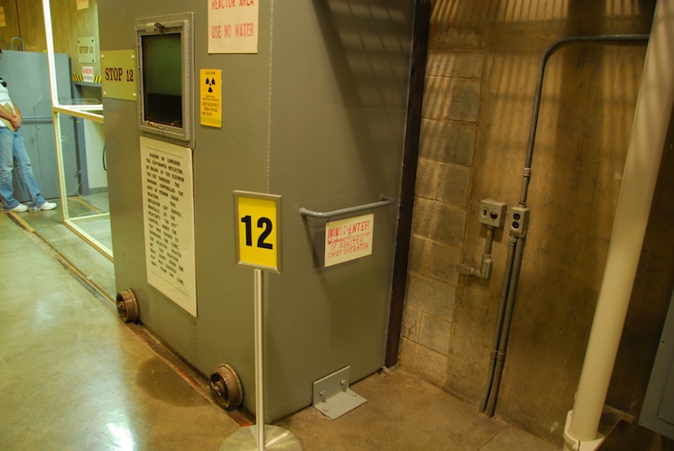
Lots of rooms with large steel and lead doors. They were on wheels and it would take two men to push them open. Some of these rooms have not been made safe and are just bolted shut. There were many signs left over from the days of operation stating to "Use No Water" in the event of a fire due to the reactor cooling system using liquid NaK.
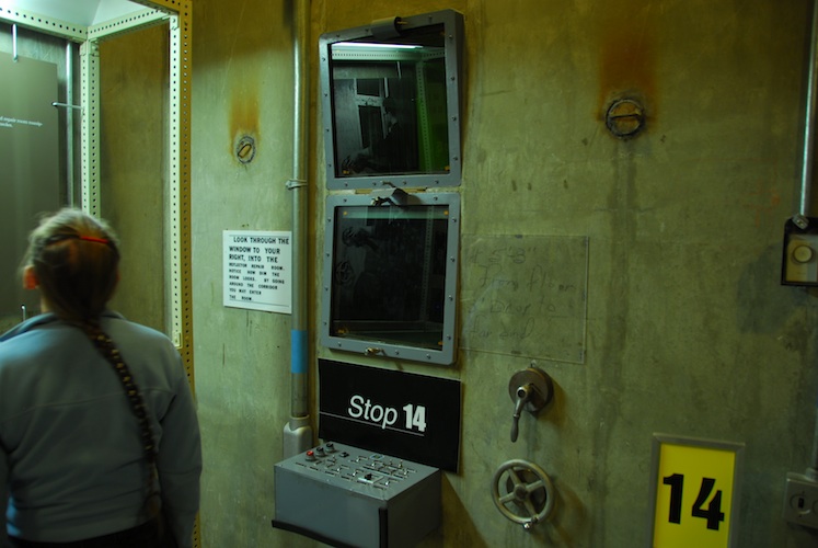
Viewing portals for seeing into the rooms and performing work by remote control.
We couldn't really see through this multi-layered glass window - the camera did a good job of capturing the image inside the room.
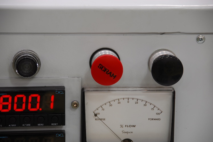
Station Control Rod Axe Man This is an historic name for the emergency shutdown of a nuclear reactor. One of the first experimental reactors was at a University and one of the heftier lads was positioned with an axe ready to swing it at the rope which was holding the control rod. Releasing the control rod would absorb the atomic particles and stop the reaction. This name stuck and apparently the SCRAM acronym is still used.
A model of the Three mile island reactor core. They had a lot of information about different reactor designs and what went wrong with Three Mile Island, Chernobyl, and Fukushima. The ERB1 was a very different design and inherently safe from overheating and meltdown due to it's NaK (Sodium+Potassium) cooling system. Now, NaK isn't the most friendly of substances in liquid form anyway, but hey, if you're going to split atoms let's not split hairs too!
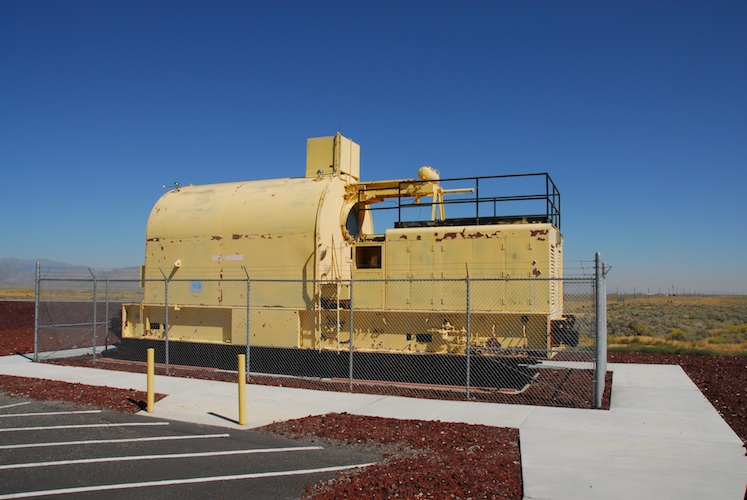
This train engine is built to be radiation proof to protect those on the inside, rather than to contain radioactive material. Adjacent to this engine they had displayed two experimental nuclear powered jet engines. The premise was that there would be no one nearby during use, so the engines didn't have to have shielding to contain the radioactivity --- just to protect the occupants of the cockpit. Not surprising, this hare brained scheme didn't get past the second prototype.
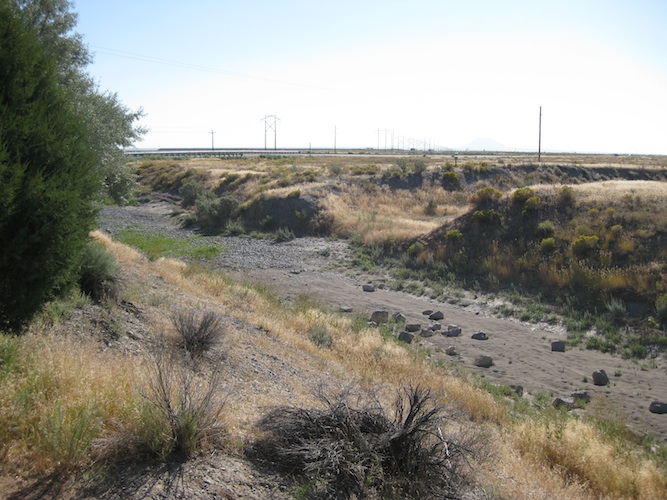
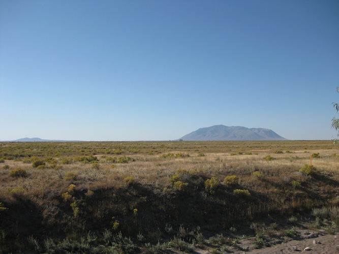
Can you visualize a better region to build a nuclear reactor in? Nothing lives here but a little sagebrush... and even that only has a tenuous grasp on life. The Lost River isn't actually a river now. It disappeared under the tectonic plates due to volcanic activity.
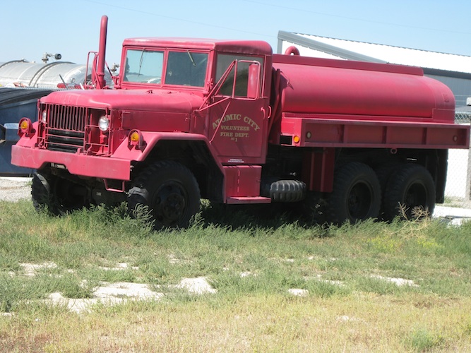
Atomic City is quite the ghost town...
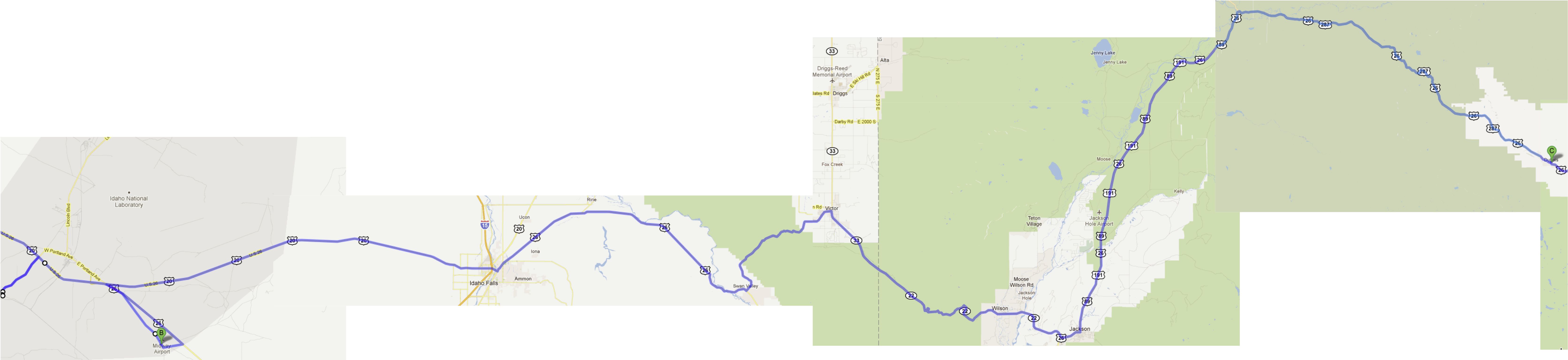
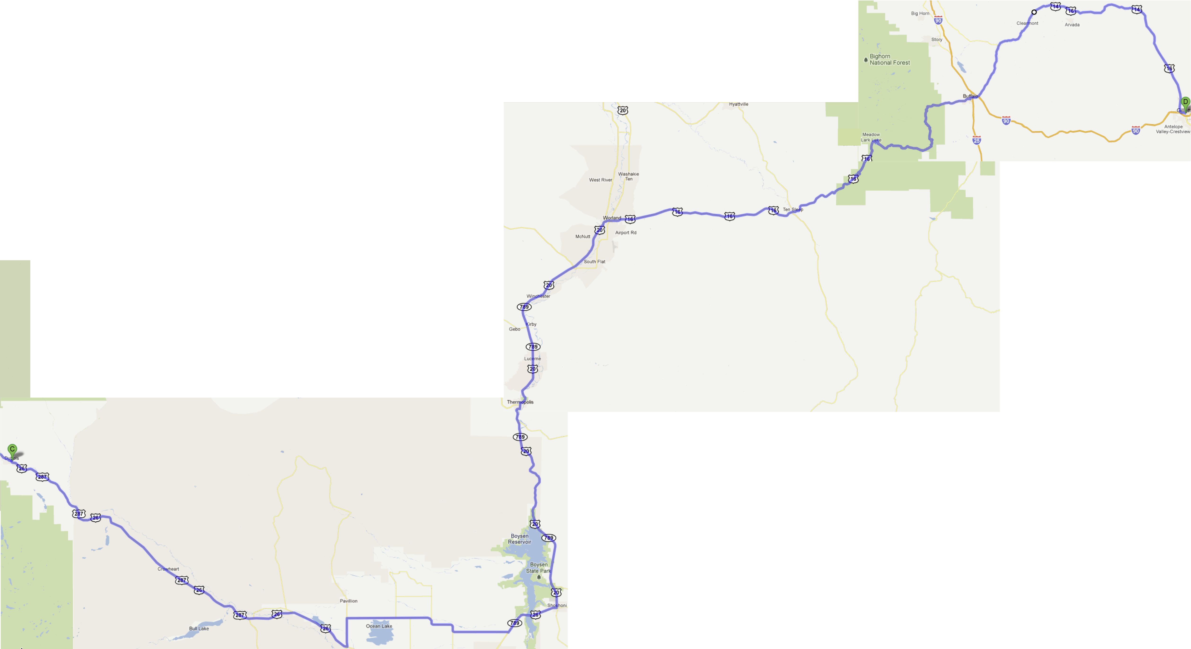
Over breakfast in Dubois, we were advised of the more interesting route to take from there "unless we liked antelope and sagebrush".
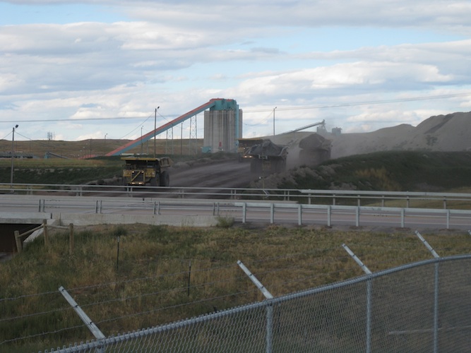
Just before Gillette we came across this coal mine. WOW! The mine itself is on one side of the highway, and the coal is trucked to the other side.
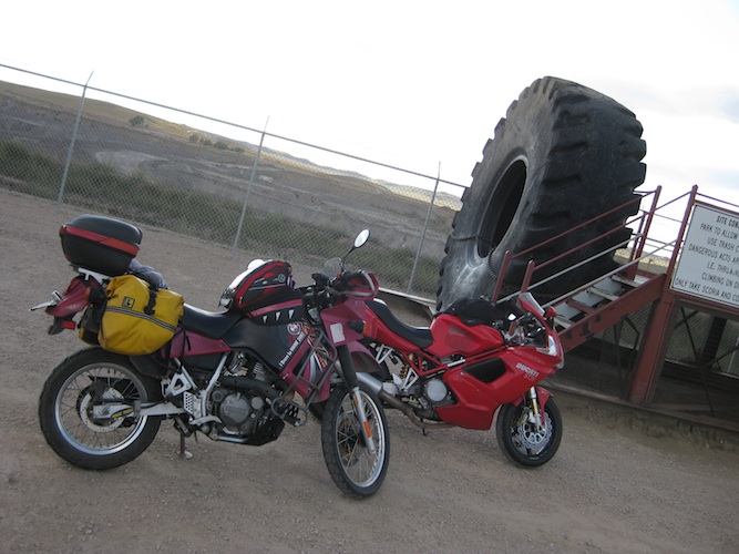
Big tires on those trucks!!!
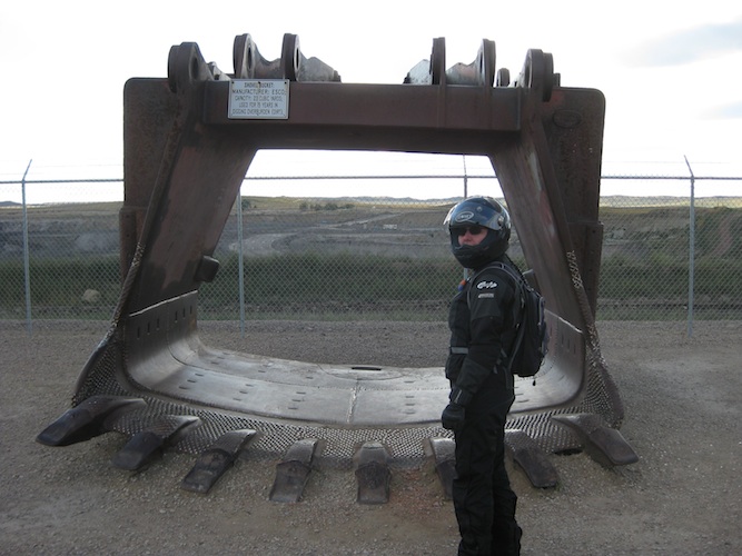
The welding work on this bucket looked really neat.
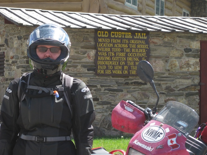
Please Mr. Custer!
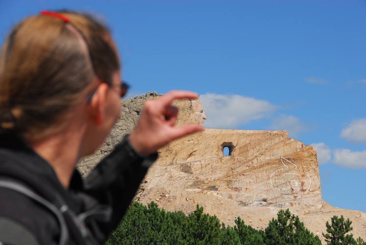
I squish your head!
The Crazy Horse monument was pretty neat. The bikes got in for half price, which was a nice touch. It is our personal opinion that they'll never finish carving the mountain, but hey, it was still neat to see.
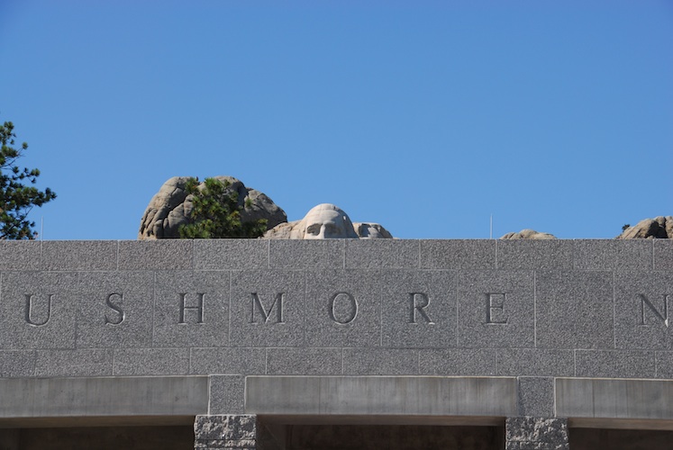
Mount Rushmore on the other hand, charges $11 for every vehicle that enters, including motorcycles, and then tells you to share a parking spot. Excuse me?! If we're paying full price we should get to take up LOTS of space!!! They try to justify their price by having the pass good until the end of the year. Um, thanks, we won't be back - we live far away!!!
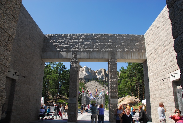
Two motorcycling couples that we met that evening over dinner confirmed that Rushmore "got smaller" when they built all the infrastructure around it. They talked about how impressive it was when the avenue of flags was a walk through the forest. Now THAT would have been neat to see!
After escaping the hoards at Rushmore, we had no interest in staying in Deadwood when we got there. Holy casinos Batman!
We hightailed it back into Wyoming after only about 6-1/2 hours in South Dakota.

Oh, the irony!
We found a nice little motel along the river in Hulett, Wyoming and enjoyed dinner with two other couples that arrived via motorcycle. Two-up on a Harley, sans helmets, and two-up on a Gold Wing trike.... Oh, we had to watch the comments we let out! Despite that, it was an enjoyable evening with lots of friendly conversation.
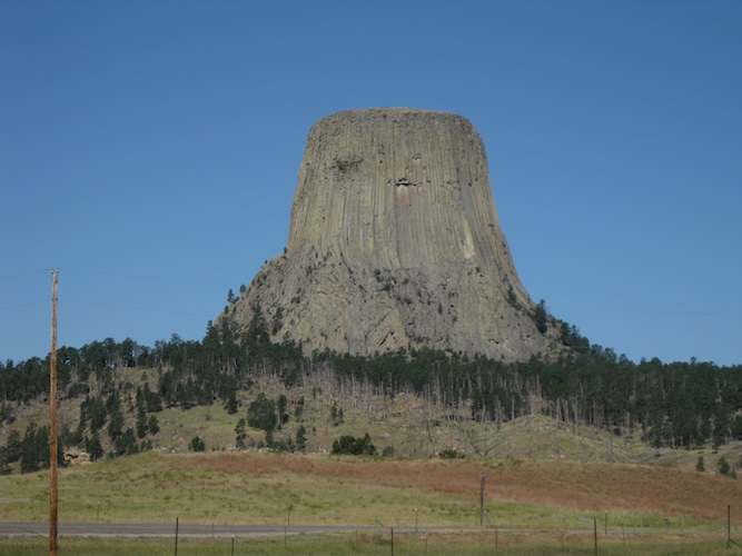
We didn't choose to go any closer to Devil's Tower than the highway. It looked really neat, but we were in the mood for riding after the previous day's tourist-ing.
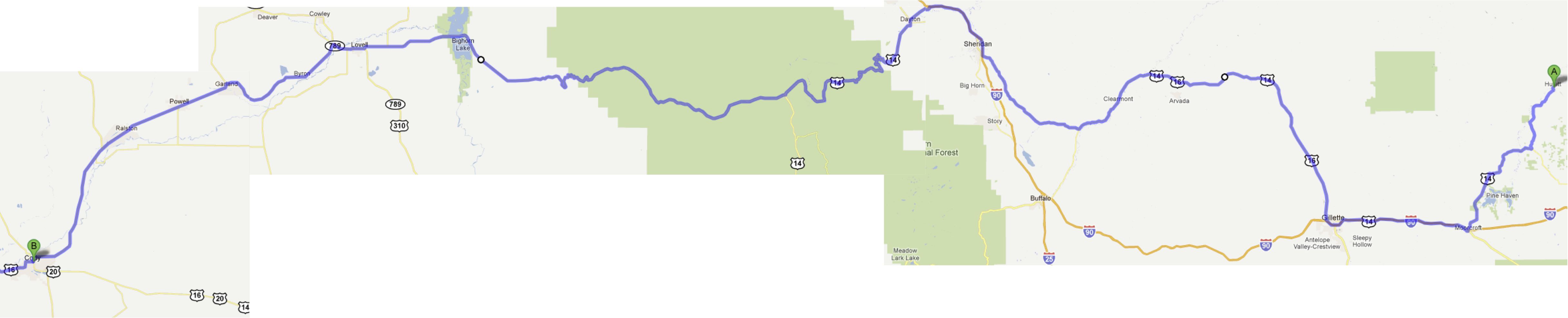
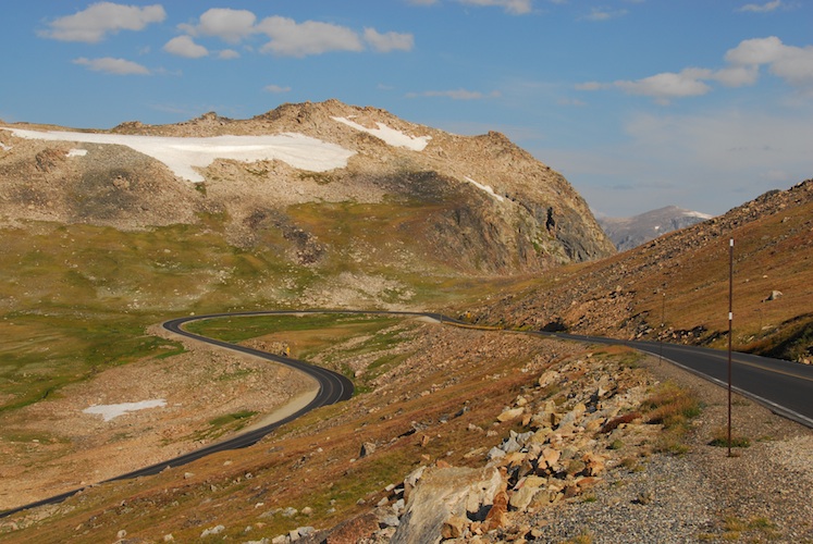
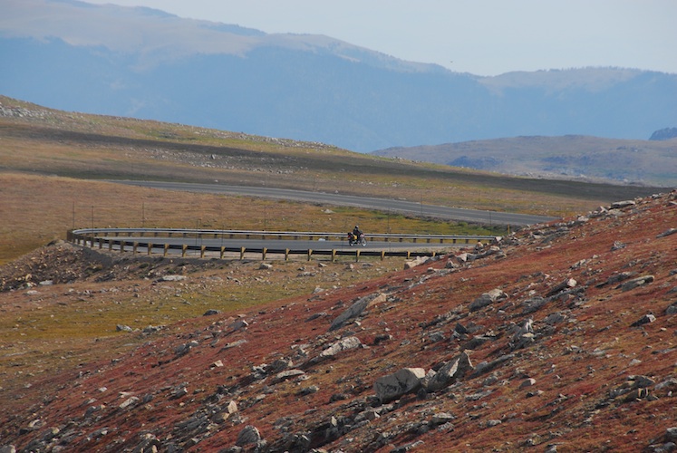
Highway 14 Alternate across the top of Wyoming is a pretty nice road at 9,430ft.
We booked into a motel in Cody, WY for two nights in order to give ourselves a full day to ride around Yellowstone, without luggage.
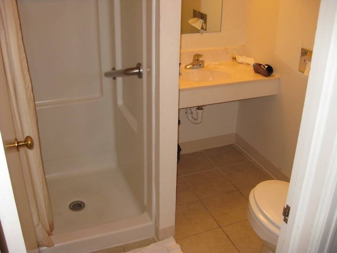
Some states must have some pretty strict laws about accessibility. Lots and lots of handicapped parking spaces, and the railing in the shower of this very-not-wheelchair-accessible bathroom.
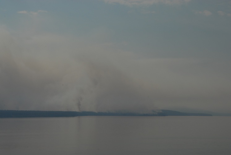
Lots of Yellowstone was on fire, with *lots* of signs telling people to NOT report the fires, as they already knew about them.
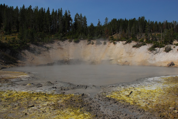
Bubbly mud.
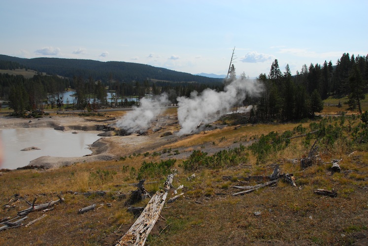
Steamy ground.
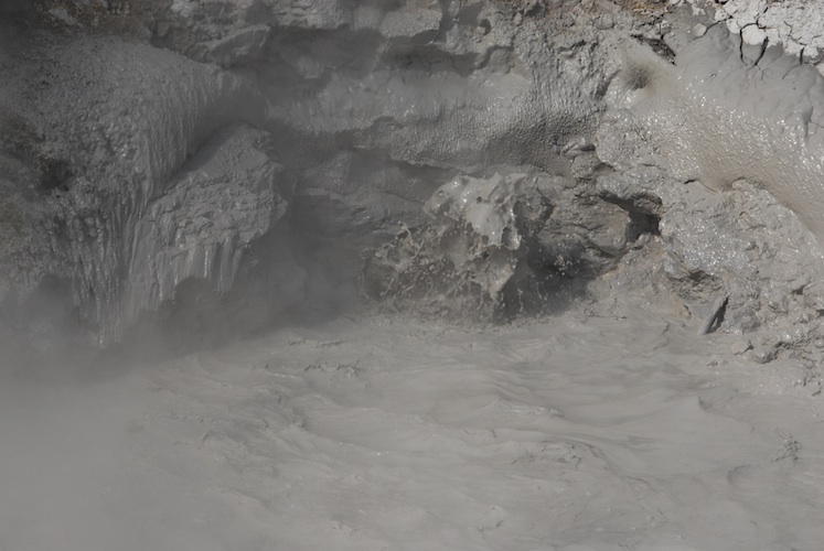
Yuck!!
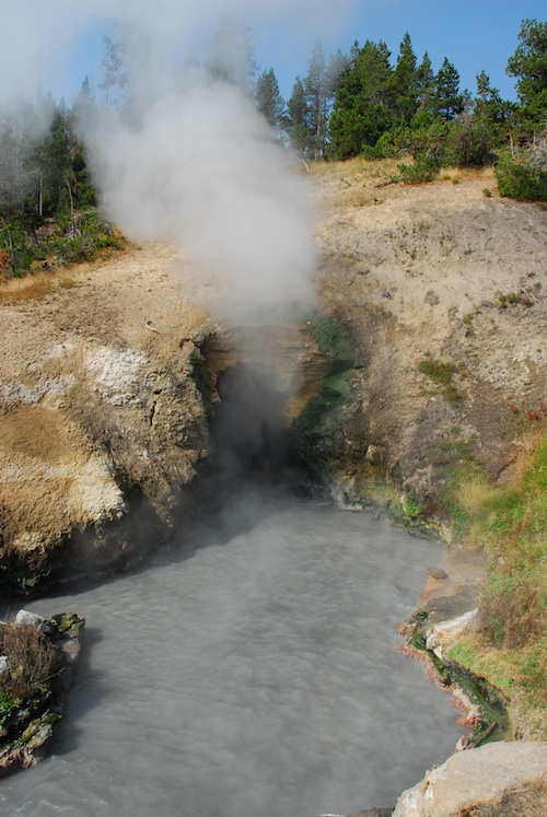
The Dragon's Cave actually sounds like a roaring Dragon.
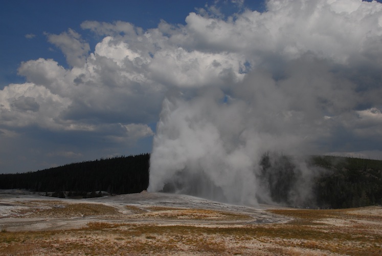
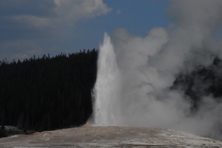
Old Faithful (we propose a re-name to Old Fickle) was kind enough to erupt while we were there.
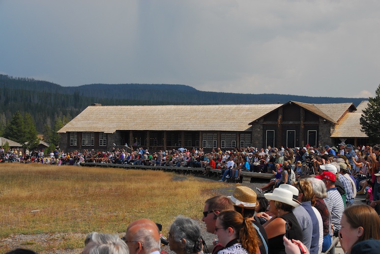
Many of these people waited hours for the next eruption, which they seem to be able to predict pretty well (but only one at a time). We're not that patient, and wouldn't have waited around, but our timing was perfect.
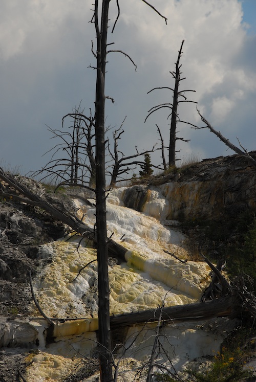
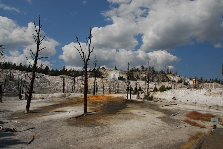
Bizarre landscape. These aren't trees from a forest fire. These are trees that burnt from the roots up due to shifts in underground heat.
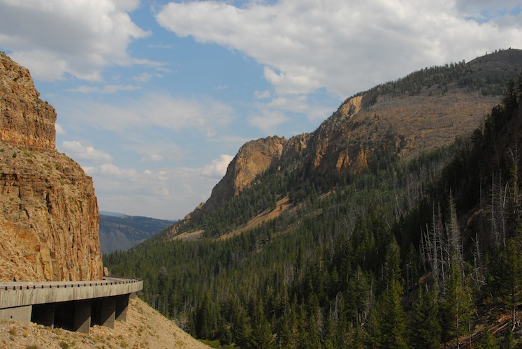
One full day of riding in Yellowstone just didn't seem to do it justice. The admission we paid was good for seven days, so we decided to head back into the park the following day.
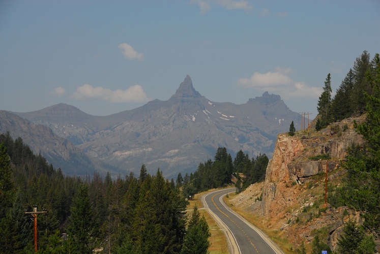
Fun roads tend to be fun in both directions, so we took the Chief Joseph scenic byway both back to Cody and back into the park the next morning.
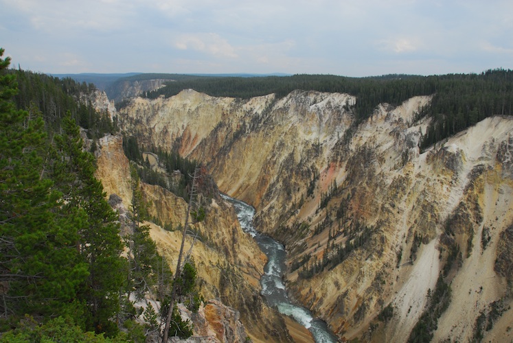
It's even hard to believe when standing there that this is not a painting.
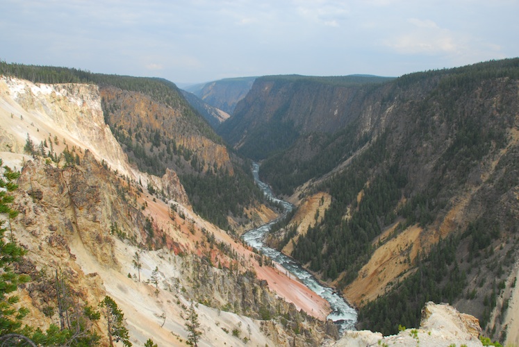
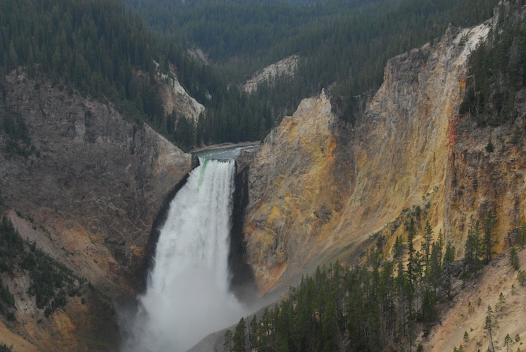
Incredible water falls.
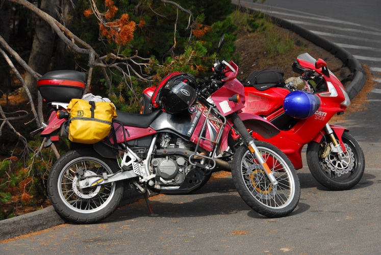
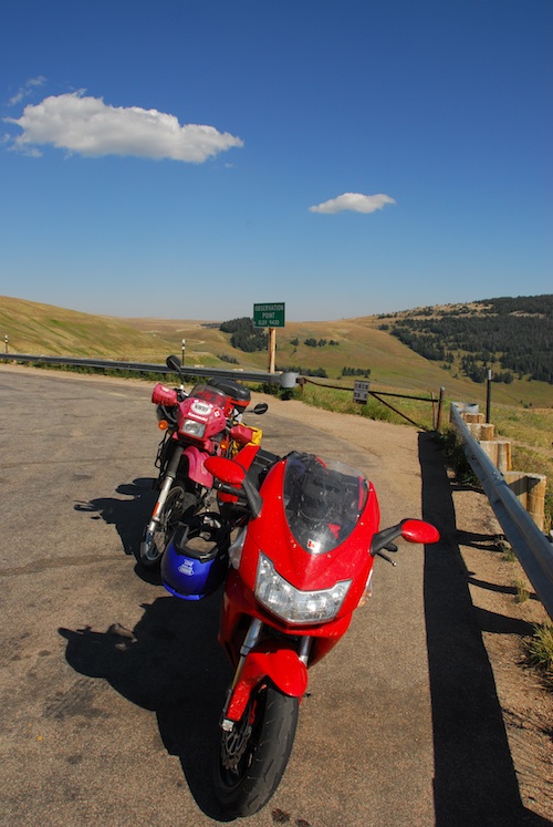
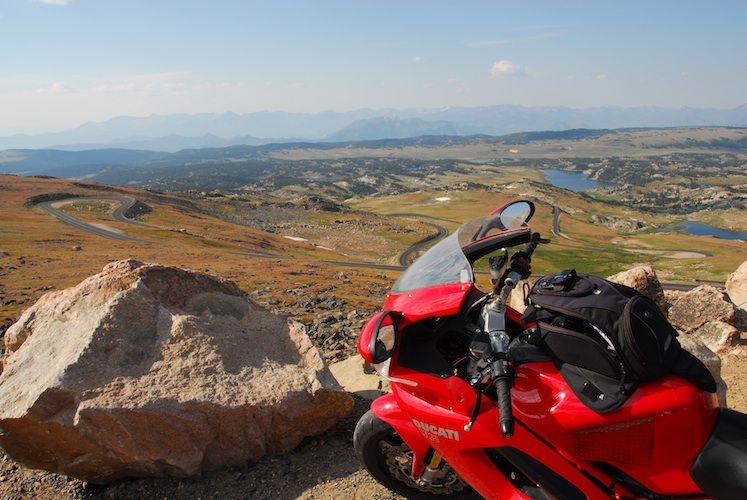
Motorcycles basking in the sun.
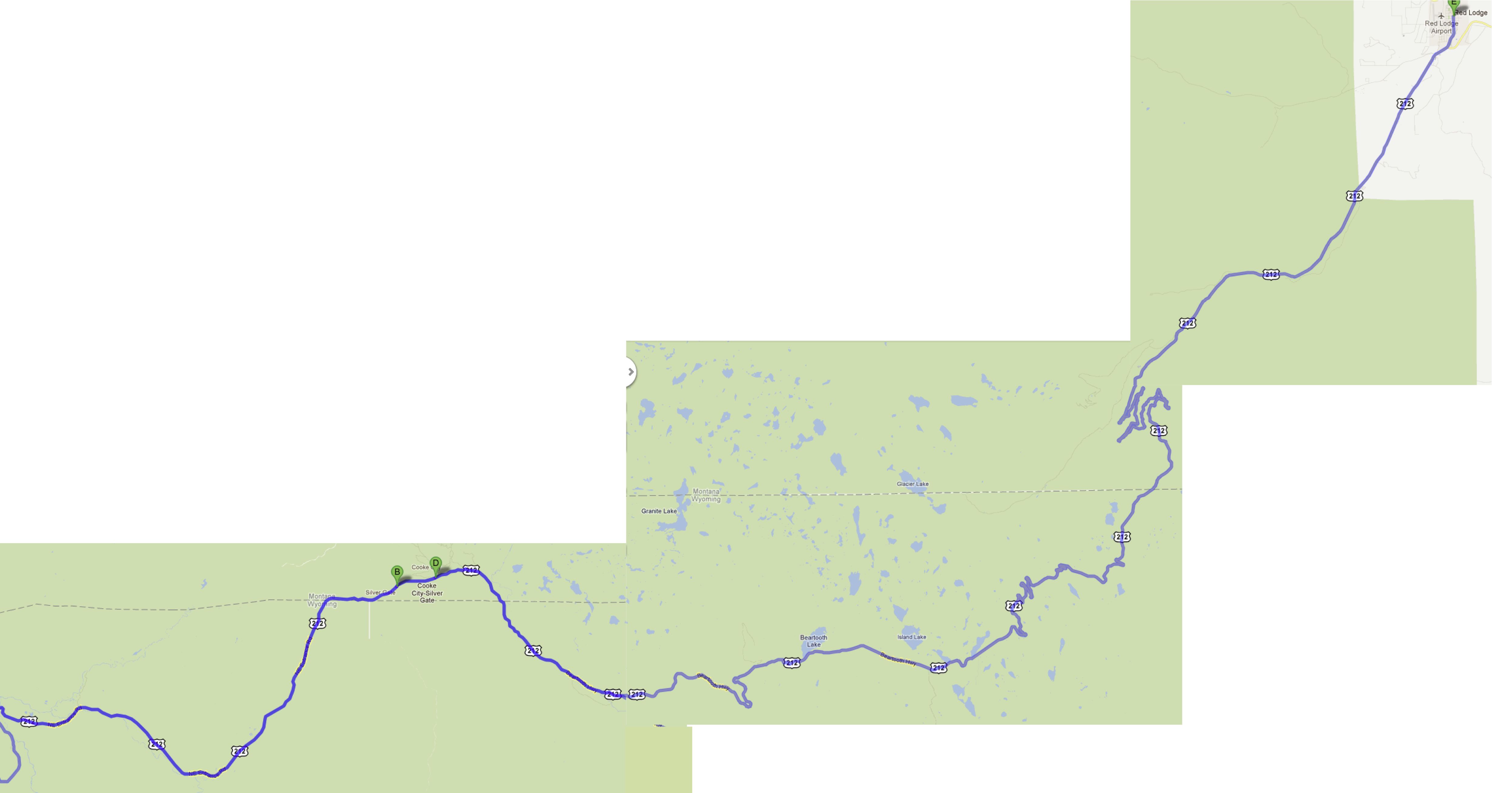
After a second day in Yellowstone we felt like we'd had our fill & happily headed out for Bear Tooth Pass and Red Lodge.
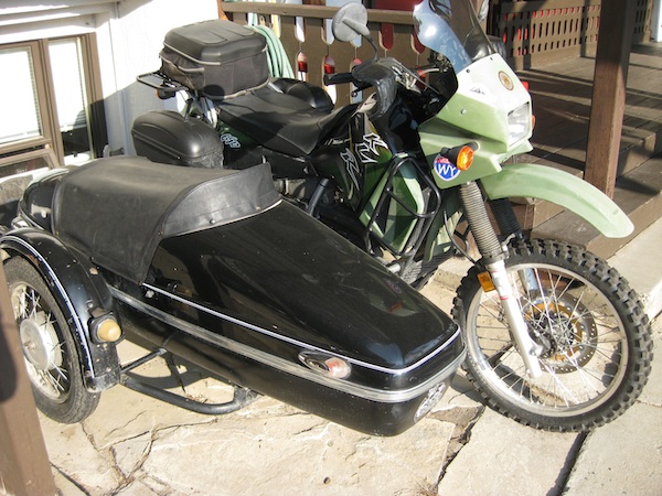
The proprietress of our motel in Red Lodge kept her KLR with sidecar parked out front. Her husband's red KLR was parked in the back.
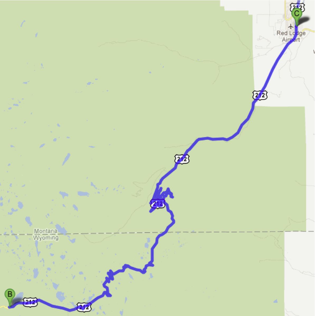
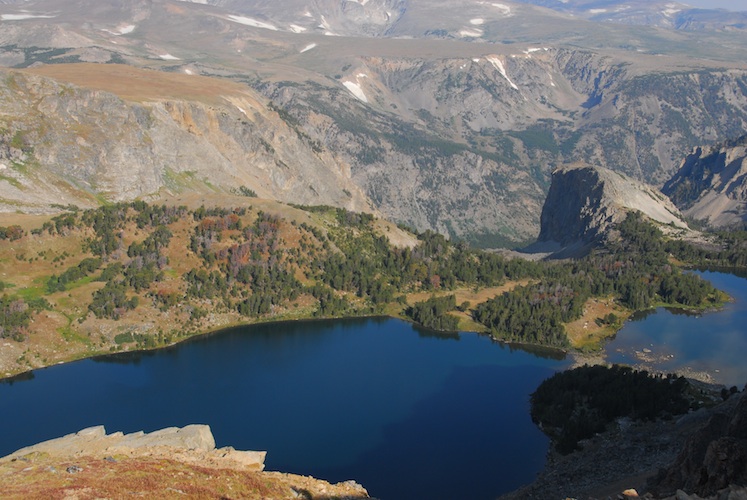
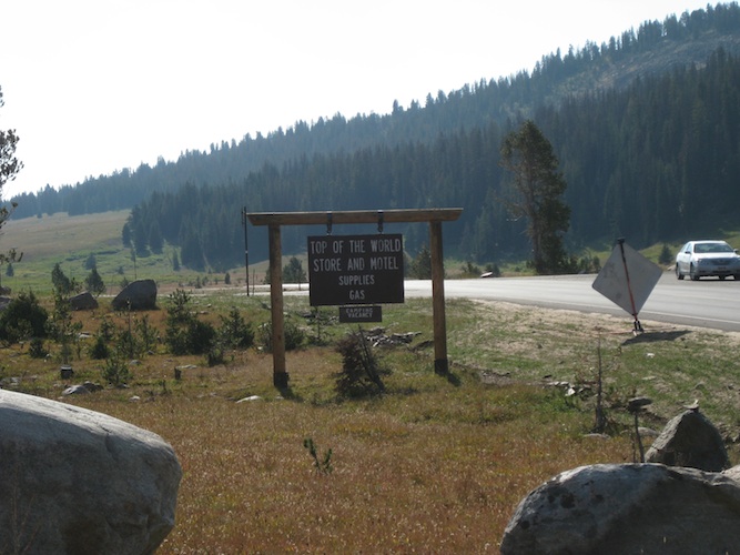
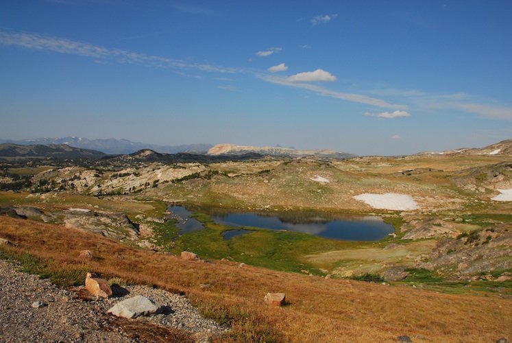
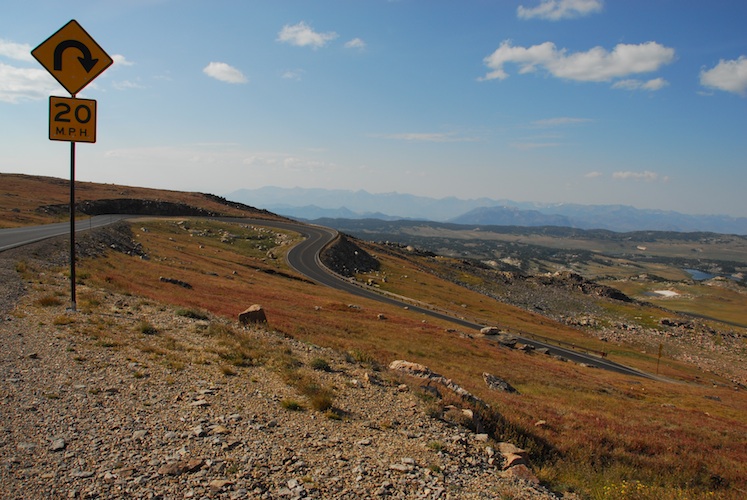
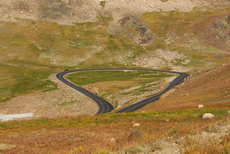
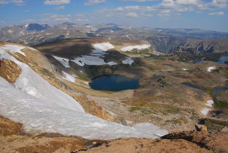
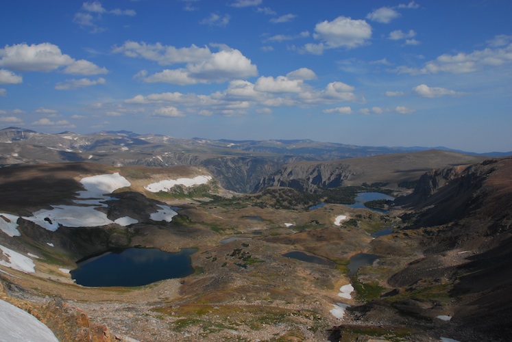
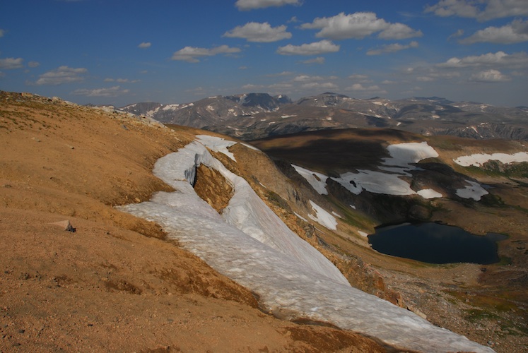
The views and riding over Bear Tooth Pass were so impressive that we decided to ride it again before breakfast the next morning. We rode to the Top of the World again and then back to Red Lodge for brunch. It was bloody cold up there! The highest point we rode through (according to our GPS) was 3400m.
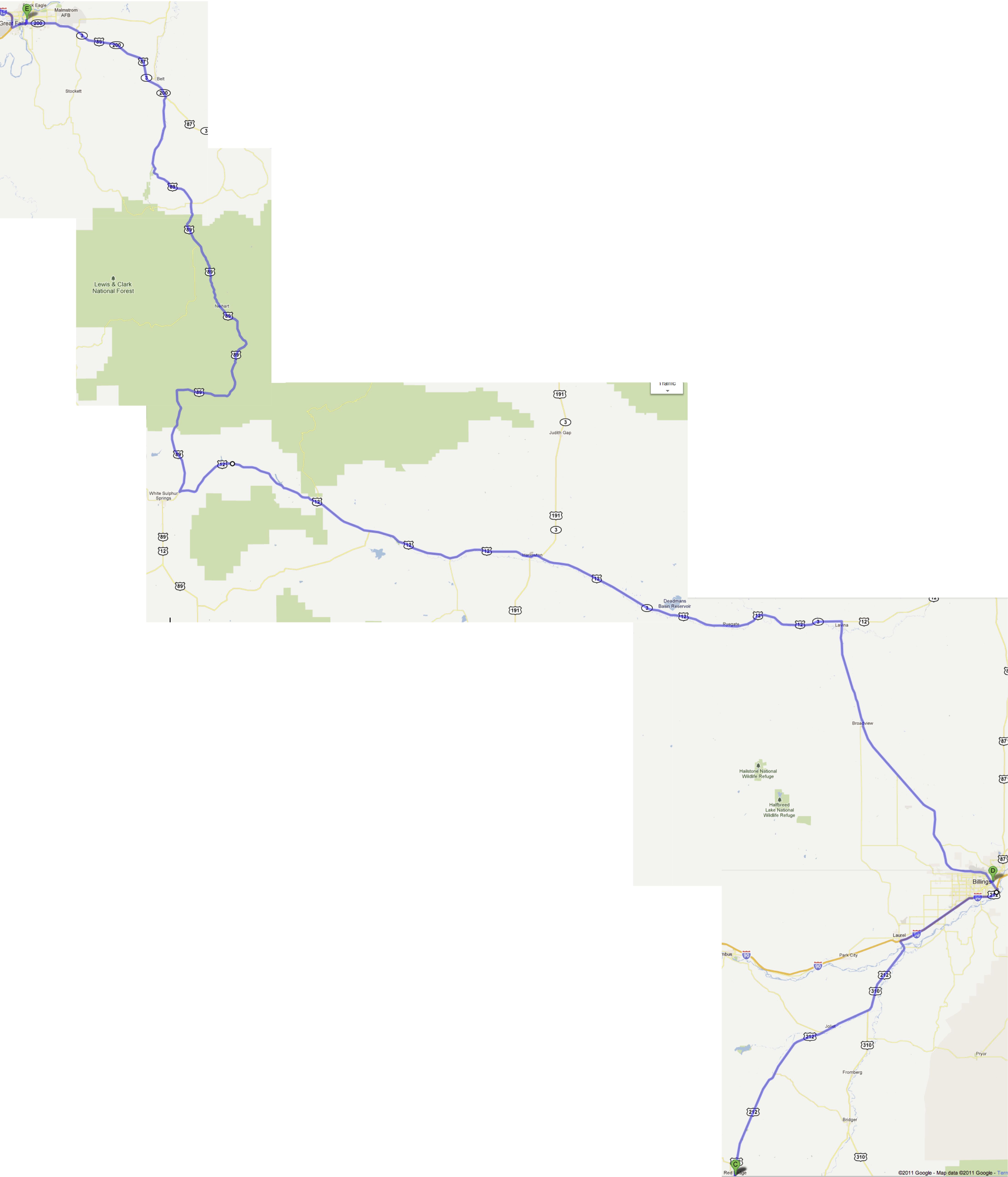
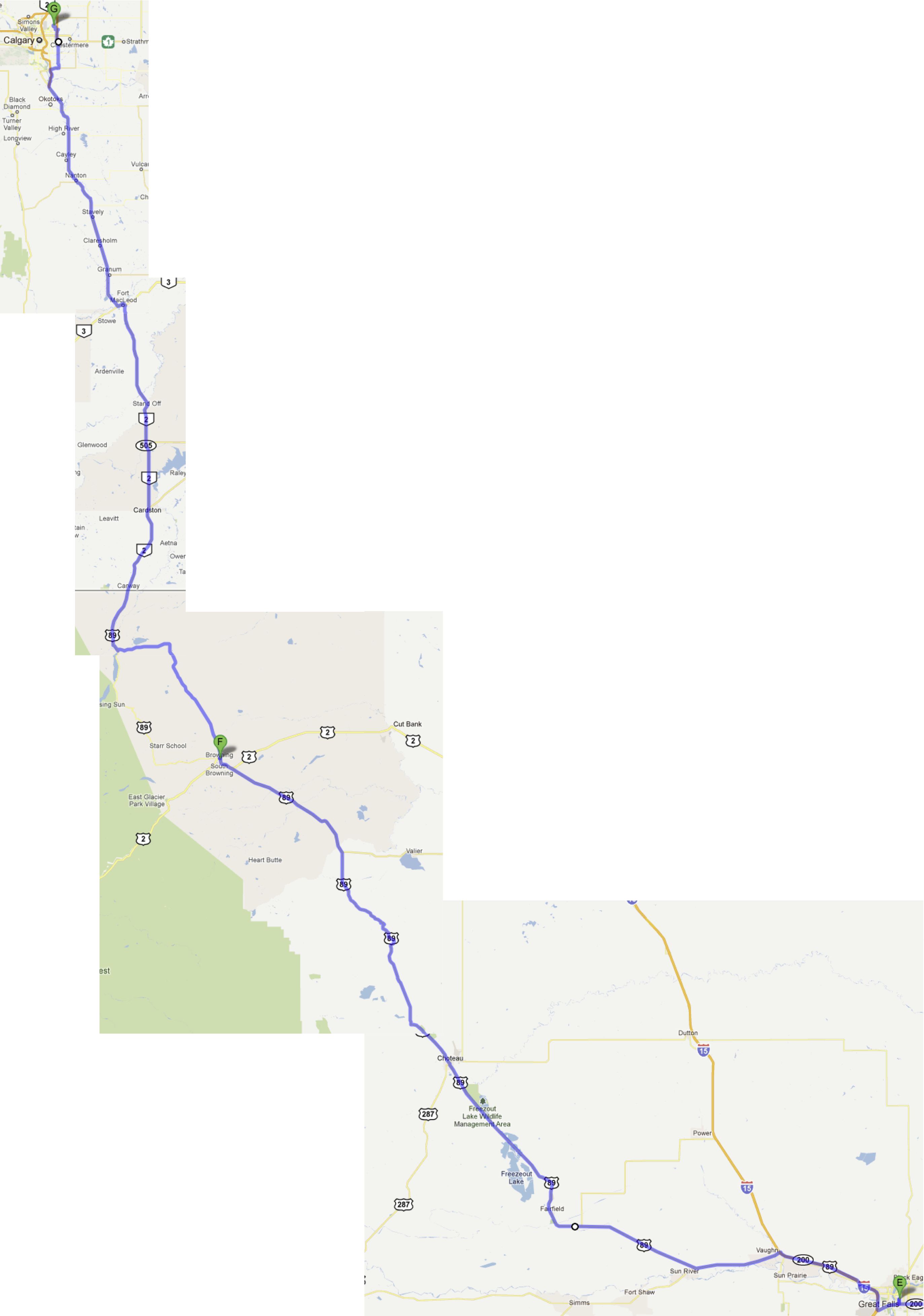
From Red Lodge we headed into a motorcycle shop in Billings to see if we could find some of the gear we have on our replacement list. No luck. Many boring roads (and a *few* more interesting ones) led us into Great Falls for the night, from where we headed for home.
A common theme for the trip was road construction - everything from signs with no action to roads torn down to the base layers.
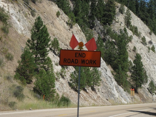
We saw plenty of these rather sedentary picketers lobbying for an end to road construction. We support their cause!
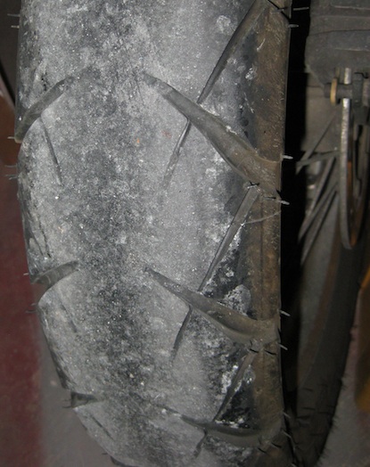
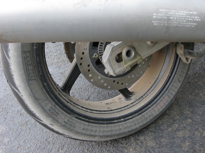
We knew when we left home that the KLR tires would be "done" after this trip. All of the chip seal we rode over acted a bit like a cheese grater... you can't see any cords in this particular view, but they are showing in one or two spots on the rear tire.
We put on just over 7200km in 14 days of riding. No rain, lots of cool temperatures, some heat. An altogether wonderful trip!